
A diorama of Auckland dating to the 1930s was lost for decades, and shows in stunning detail the central city with light rail right through it, and before huge chunks of it were demolished. By Duncan Greive, images by Joel Thomas.
Who ruined central Auckland? As we contemplate a decades-long healing process – building the apartments, the light rail, the cycle lanes and subways that we somehow forgot to – I often wonder about those who laid waste to this city during that vague time period from the ‘70s through the ‘00s when so many of its best buildings were knocked down, to be replaced by cheap, ugly boxes designed to be sold but not to be lived in. When we determinedly marched away from the needs of the future to save a few dollars in the present.
Some combination of developers, planners, architects, politicians and voters conspired to plunder many parts of the central city, taking vibrant areas and sapping them of their utility and history. We’re left with the paper thin facade of the former BNZ on Queen St, that grotesque crimson building on the corner of K Rd and Queen St, the preposterously-named Ivy League apartments rolling down Hobson St and dozens more which have collectively rendered whole districts ill-conceived and lifeless.
The worst part is that very few of us remember what the city was like before the war began. Unless we have a good memory and were born in a particular era, we cannot know the department stores torn down to be replaced by leaky buildings. The tram systems replaced by car funnels. The retail districts and industrial areas repurposed into long-vacant land banks. It’s the city we know existed but has vanished.
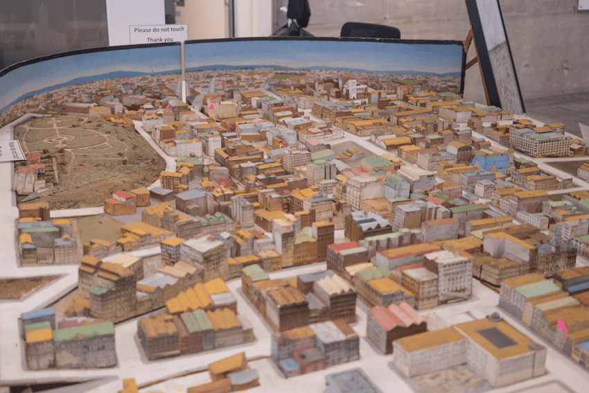
Only, it does exist, in a way. Late last year I had a beer with Chris McDowall, the creator of a number of magical pieces of data visualisation for The Spinoff. He had just come from meeting a friend at the Council, and had happened upon something quite special: a large diorama of the city, dating from the 1930s.
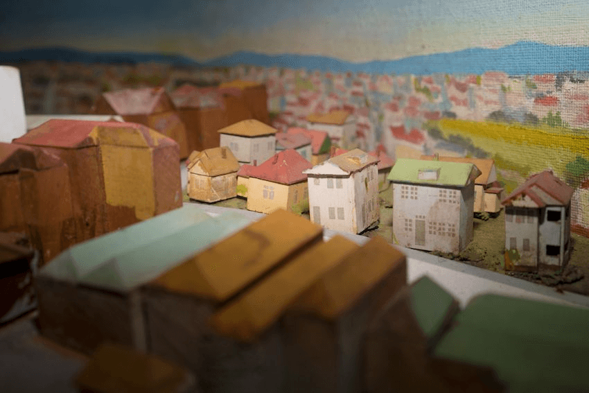
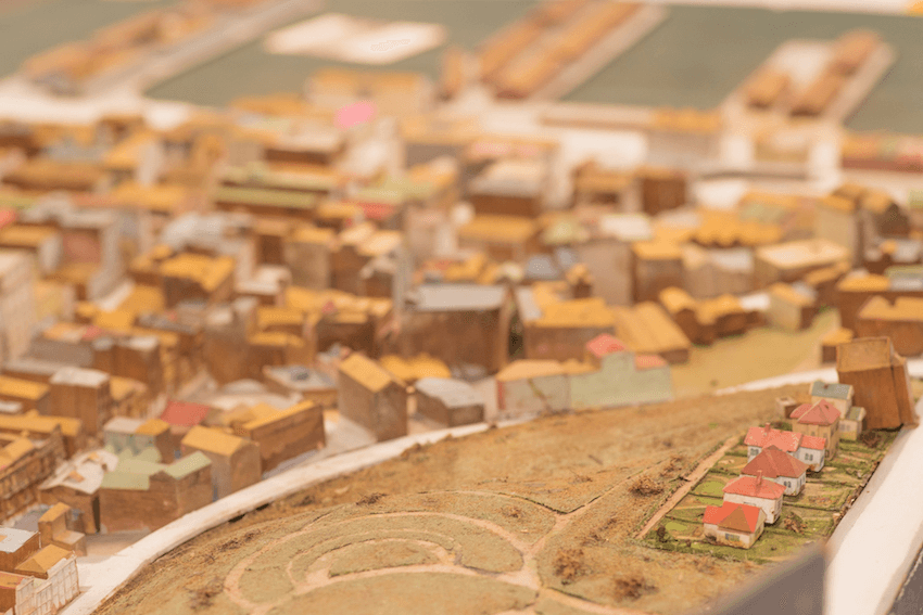
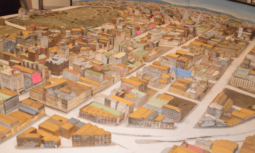
He pulled out his phone and showed me some images, and the pair of us marveled at its intricate detail – lower Albert St before the downtown shopping centre came and went; the way Hobson and Nelson rivaled Queen St as shopping precincts. It was a map of the city as it was and might have still been, had the great demolition not happened. I had to see it.
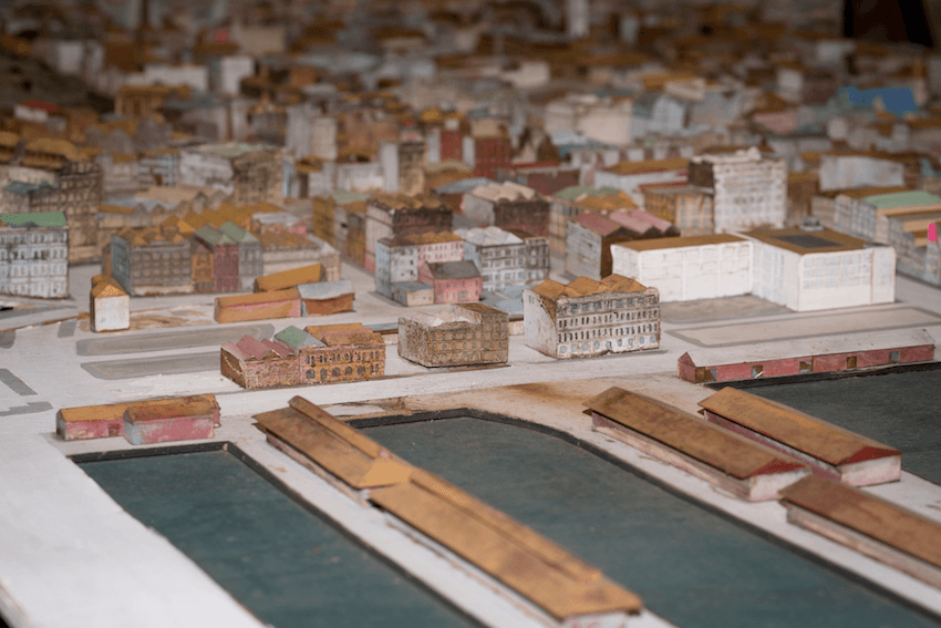
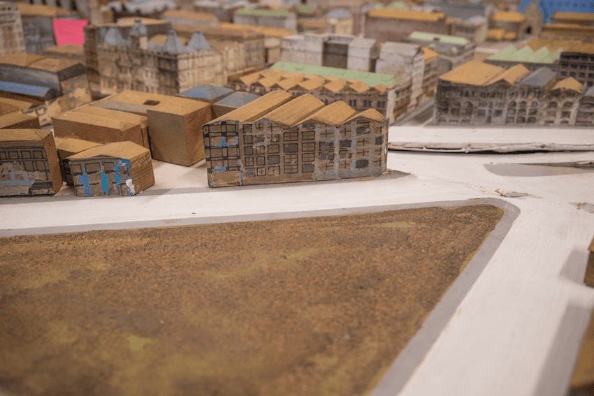
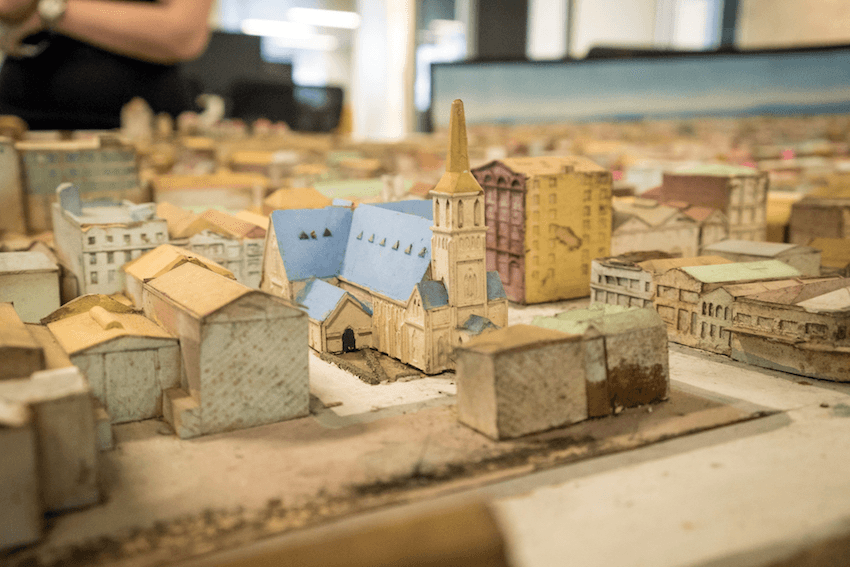
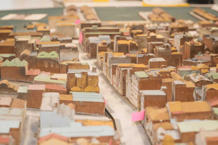
So on sweltering day late last year I was taken up to the 17th floor of the Council’s mid-town tower and walked through to the diorama, laid out across some white tables amongst some of the planners. I gazed at it in something like awe – a multi-dimensional map of ground familiar to all who’ve lived, worked or gone out in the central city, yet with an entirely different texture.
It’s perhaps six metres long by three wide, and is displayed in a makeshift way across some desks and tables requisitioned for the task.
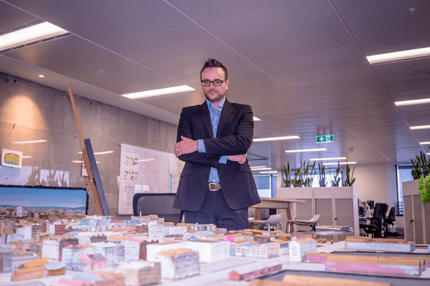
Alongside it is John Duguid, the Council’s manager of the plans and places department, who rediscovered the diorama recently. Its history mirrors that of the city itself, in that it has been lost and mistreated, displayed at AUT at one time, while mostly languishing unloved. This extends to another, bigger and more recent diorama, which is too large to be displayed anywhere.
What’s interesting about Auckland’s is that it predates the city diorama craze, according to Duguid, who cites Sydney’s example, preserved under glass and beautifully lit, as an example of what he’d like to do with Auckland’s. “Most cities have models like these,” he says, “but I’ve never seen any as old as this.”
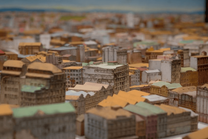
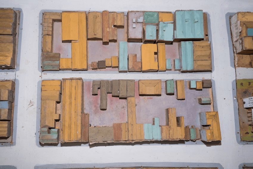
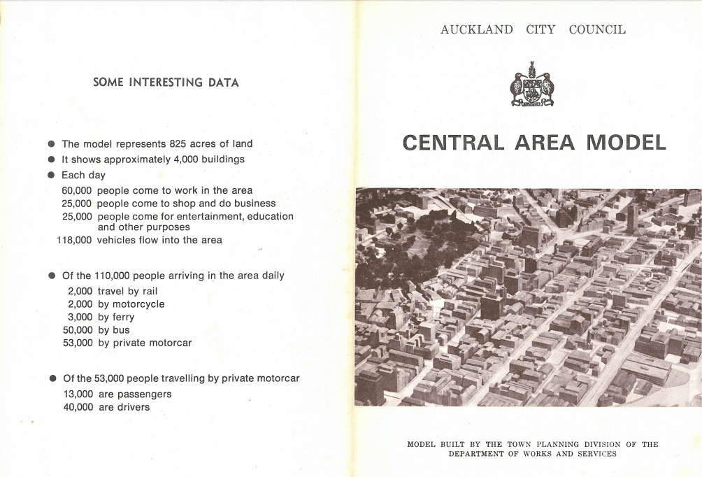
Old – and also intricate. Many preserve shapes and work to scale. Far fewer have the outside surfaces detailed too, but Auckland’s – made of cedar blocks with painted paper on the exteriors – renders a startling detailed recollection of the city. It was built “as an aid to the planning and redevelopment of the inner city area” by the “town planning division of the department of works and services”. Which is to say that they understood about the need to recognise context and build coherently nearly a century ago – but somehow forgot in the 80s and 90s.
“It’s a fairly well agreed statement that there was this obsession with building fantastic buildings that don’t necessarily respect the context,” says Duguid of the era when a lot of this was knocked down.
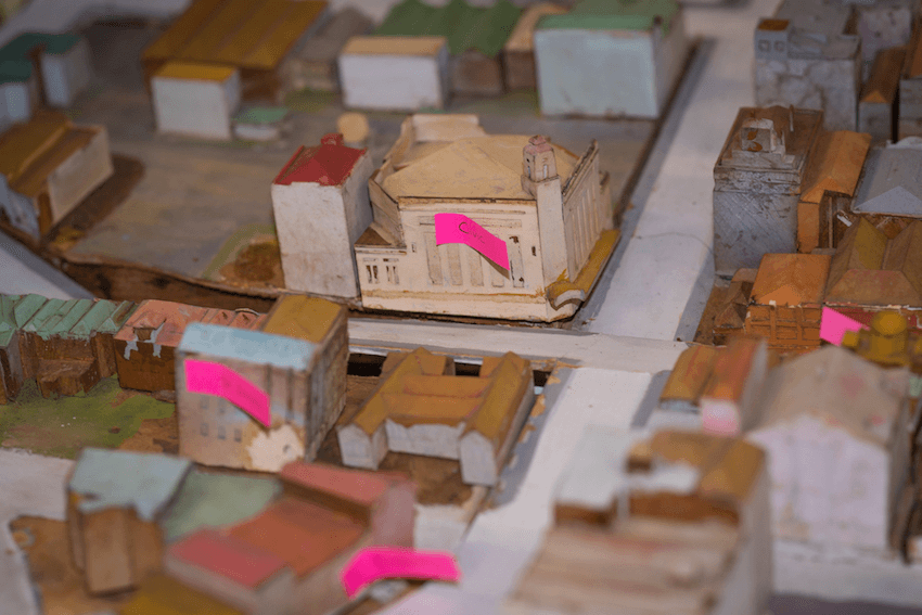
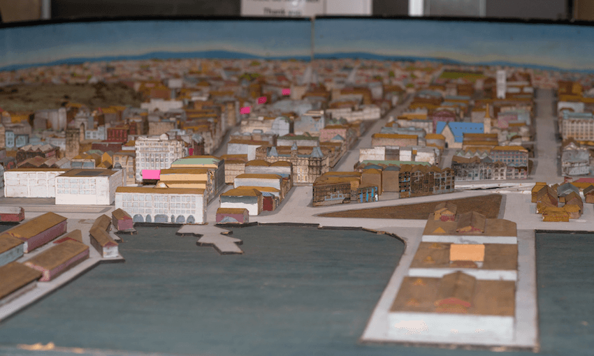
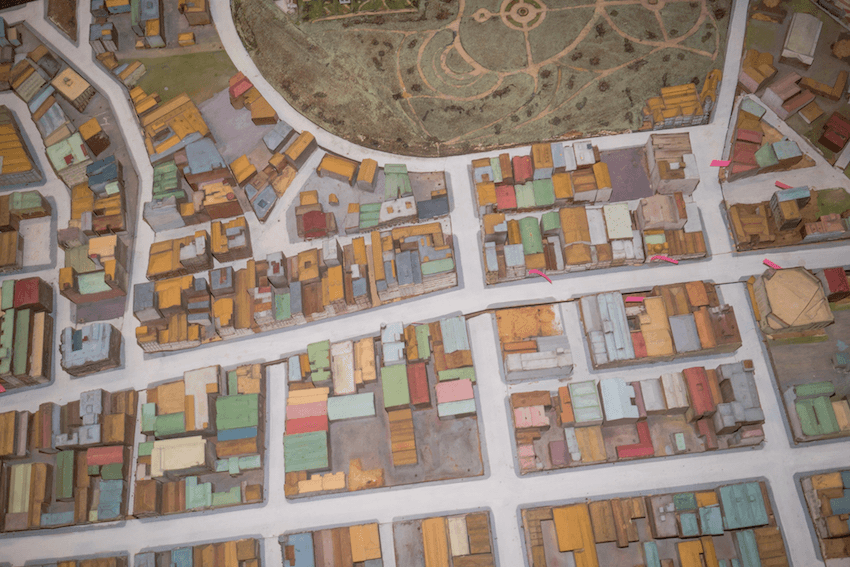
It’s impossible to gaze on it and fail to wonder about what might have been. The city teemed with possibility – there were large open spaces ready for development, and its heritage need not have precluded its evolution. It also reveals the way the cultural life of the city has evolved, the way meeting and going out has radically changed in the past 80 years.
“Pubs and theatres,” says Duguid of what is gone. “We’ve lost a lot of theatres. The infamous one that was maybe a tipping point for an awareness of heritage, there was a bit of outrage in the 80s. I think it’s where the mid-city cinema was built.”
Mid-City cinemas opened in 1984, with David Lange and Sam Neill amongst the stars attending. It’s emblematic of the pace and promise of the development boom – the One News clip shows gleaming glass and escalators and a slice of international life as New Zealand started to emerge from the chill of Muldoonism. And yet less than 20 years later it was abandoned and largely inaccessible, the way it remains to this day. Complexities around ownership and redevelopment have left it frozen in time, a monument to what we pulled down and how little we thought about what would replace it.
“It’s probably because people were excited about the motorways and car travel and the high rise,” says Duguid. “It was all exciting, because could Auckland be like New York and clearly people aren’t architects – so they were all into concrete and steel.” Whole sections of the city which were soon cleaved and isolated by tarmac are visible and viable, speaking to paths to development and transportation not taken.
It’s only been in recent years that development has started to feel like it has been managed by the city. That places like Wynyard Quarter, Freyberg Place and have shown what a more holistic approach to central city revitalisation can look like. In many ways it began with Britomart, Peter Cooper’s vision for a revived downtown which has helped serve as a signal for what mixed use developments can be, how they should be managed in stages and peopled with different kinds of tenants (The Spinoff works out of Britomart, across the square from the headquarters of Westpac). In this way the city of past can serve as a helpful guide to the city of the future.
“We’re maybe moving back that way a little bit with things like the restoration of Britomart, and things happening on like Elliott Street,” says Duguid. “We’re starting to bring places back to life.”
What follows are a selection of images of the diorama and its accompanying materials, taken by Joel Thomas: